


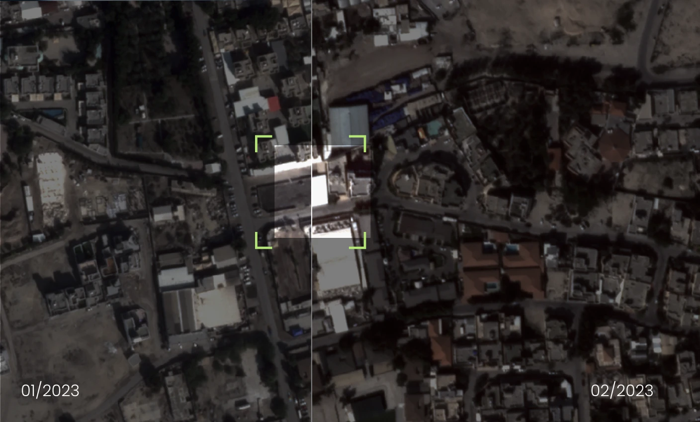


Variable Rate Technology: What
Is This And How It Works
From day one, Aetosky
delivers actionable intelligence, enabling every level of your organization to make precise, data-driven
decisions.
| 15.07.2023
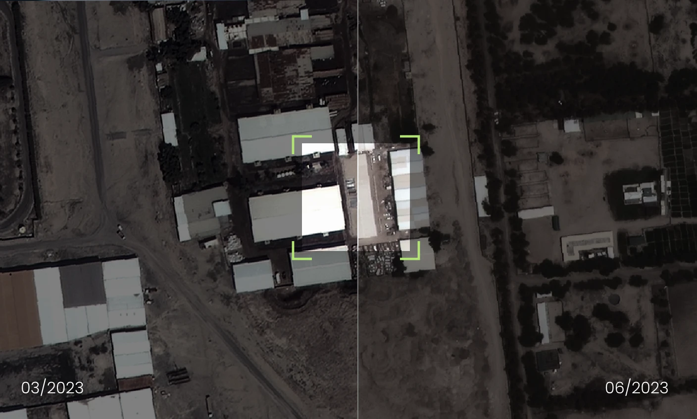
Variable Rate Technology: What
Is This And How It Works
From day one, Aetosky
delivers actionable intelligence, enabling every level of your organization to make precise, data-driven
decisions.
| 15.07.2023
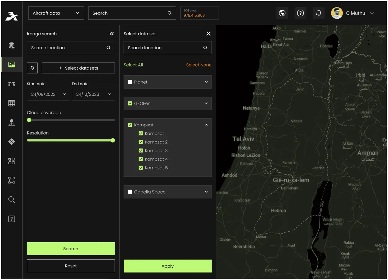
Variable Rate Technology: What
Is This And How It Works
From day one, Aetosky
delivers actionable intelligence, enabling every level of your organization to make precise, data-driven
decisions.
| 15.07.2023
